Ph.D. - Geographic Information Sciences
University of South Carolina - 2000

Professional Preparation
M.S. - Geographical Information Systems
Chinese Academy of Sciences - 1993
Chinese Academy of Sciences - 1993
B.S. - Geography with GIS emphasis
China Normal University - 1990
China Normal University - 1990
Research Areas
Research Interests
Remote Sensing Digital Image Processing, LIDAR and Hyperspectral Remote Sensing, Neural Network and Fuzzy Logic, Spatial Analysis and Modeling, GIS Application Software Development, and Web-based Mapping and Information Processing.Publications
Sridharan, H., F. Qiu, 2013. A spatially disaggregated areal-interpolation model using LiDAR derived building volumes,Geographic Analysis. In Press. 2013 - Publication
Qiu, F., F. Ni, B. Chastain, H. Huang, P. Zhao, W. Han, and L. Di. 2012.
GWASS:GRASS web application software system based on the GeoBrain web service,
Computers & Geosciences. doi:10.1016/j.cageo.2012.01.023. 2012 - Publication
Zhang, C. and F. Qiu. 2012. Mapping individual tree species in an urban forest using
airborne LiDAR data and hyperspectral imagery, Photogrammetric Engineering and
Remote Sensing. Accepted (Winner of 2012 AAG Remote Sensing Specialty Group Early
Career Paper Award). 2012 - Publication
Zhang, C. and F. Qiu. 2012. Mapping individual tree species in an urban forest using LiDAR data and hyperspectral imagery, Photogrammetric Engineering and
Remote Sensing. Accepted (Winner of 2012 AAG Remote Sensing Specialty Group Early
Career Paper Award). 2012 - Publication
Qiu, F., C. Zhang, and Y. Zhou, 2012, The development of an areal interpolation ArcGIS extension and a comparative study, GIScience and Remote Sensing.Vol. 49 (5), 644-663. doi:10.2747/1548-1603.49.5.644 2012 - Publication
Qiu, F., B. Chastain, C. Zhang. 2011. Modeling land suitability/capability using fuzzy
evaluation, GeoJournal. Accepted. 2011 - Publication
Zhang, C., F. Qiu. 2011. A point-based intelligent approach to areal interpolation,
Professional Geographer. Vol. 63, No. 2, 262-276. 2011 - Publication
Curtin, K. M., K. L. Hayslett-McCall, and F. Qiu, 2010. Determining Optimal Police
Patrol Areas with Maximal Covering and Backup Covering Location Models, Networks
and Spatial Economics, DOI 10.1007/s11067-007-9035-6. Vol. 10, No. 1, 125-145. 2010 - Publication
Appointments
Professor
University of Texas at Dallas [2014–Present]
School of Economic, Political and Policy Sciences
University of Texas at Dallas [2014–Present]
School of Economic, Political and Policy Sciences
Department Head
University of Texas at Dallas [2013–Present]
School of Economic, Political and Policy Sciences
University of Texas at Dallas [2013–Present]
School of Economic, Political and Policy Sciences
Associate Professor with tenure
University of Texas at Dallas [2006–2014]
School of Economic, Policy and Policy Sciences
University of Texas at Dallas [2006–2014]
School of Economic, Policy and Policy Sciences
Assistant Professor
University of Texas at Dallas [2000–2006]
School of Social Sciences
University of Texas at Dallas [2000–2006]
School of Social Sciences
Research Assistant and Instructor
University of South Carolina [1996–2000]
University of South Carolina [1996–2000]
Director and Certified Instructor
Chinese Academy of Sciences [1994–1996]
Chinese Academy of Sciences [1994–1996]
Research Associate
Chinese Academy Sciences [1993–1994]
Chinese Academy Sciences [1993–1994]
Additional Information
Research Grants
- Urban Forest Inventory Based on Airborne LIDAR and Hyperspectral Imagery, funded by Dallas Urban Forest Advisory Committee, 9/1/2008- 8/31/2009. $50,000
- Efficient Spatial-Temporal Analysis of Environment and Public Health Related Dataâ€, with W. Wu and E. Sha, funded by National Science Foundation(NSF0513669), 9/1/2005 - 8/31/2008. $397,504.00
- Genetic, Behavioral and Lifestyle Risk Factors for Complications of Type 2 Diabetes in a Mexican American Population in the Lower Rio Grande Valley, with J. McCormick, funded by Centers for Disease Control and Prevention (CDC). 8/1/2005-8/1/2006. $496,000, ($42,687 Subcontract to UTD)
- Waste-To-Energy: Strategic Geographic Planning Tool Development, Phase II, with K. Curtin and R. Briggs. Funded by Environmental Protection Agency (EPA). 9/1/2005-12/31/2006. $110,000.
- Waste-To-Energy: Strategic Geographic Planning Tool Development, with R. Briggs, and K. Curtin. Funded by Environmental Protection Agency (EPA). 10/1/2004-12/31/2005. $65,000.
- NASA EOS Higher-Education Alliance: Mobilization of NASA EOS Data and Information through Web Services and Knowledge Management Technology for Higher Education Teaching and Research, with L. Di, Z. Xia and W. Luo, funded by the National Aeronautics and Space Administration (NASA:E6001682). 2/1/2004-1/31/2009. $3,000,000 ($70,000 Subcontract to UTD)
- Develop Internet Map Mapping Sites Using ESRI ArcIMS Software for the City of Rowlett, PI. Funded by City of Rowlett, TX. 2004-2005. $6,000
- Center of Excellence in Spatial Information Technology, Oracle Corporation Award, 07/01/2002, Software donation worth of $304,695.00.
Professional Service
2013- Vice Chair, Treasurer, Board Member, AAG Spatial Analysis and Modeling Specialty (SAM) Group
- Judge, AAG Spatial Analysis and Modeling Specialty (SAM) Group Best Student Paper Competition
- Member, External Advisory Committee, GIS Department, Collin College
- Member, Program Committee, Geoinformatics Conference, 2013
- Panel Reviewer, National Science Foundation (2 times)
- Reviewer, Geographical Analysis
- Reviewer, International Journal of Geographic Information Sciences
- Reviewer, ISPRS Journal of Photogrammetry and Remote Sensing
- Reviewer, GIScience and Remote Sensing
- Reviewer, Frontiers of Earth Sciences (2 times)
- Review, Geoinformatics (5 times)
- Review, SAM Student Paper Competition (9 papers)
- External Faculty Promotion Reviewer, Sun Yat-set University 16
- Guest Editor, Special Issue on Areal Interpolation and Dasymetric Modeling, Geographical Analysis.
- Vice Chair, Treasurer, Board Member, AAG Spatial Analysis and Modeling Specialty (SAM) Group
- Member, Program Committee, Geoinformatics Conference, 2012
- Reviewer, Geographical Analysis
- Reviewer, GIScience and Remote Sensing
- Reviewer, IJGIS (3 times)
- Reviewer, Journal of Applied Remote Sensing
- Reviewer, IEEE Transactions on Geoscience and Remote Sensing
- Reviewer, Geoinformatics (6 times)
- Reviewer, GeoCarto Internation
- Reviewer, Annals of American Association of Geographers (2 times)
- Vice Chair, Treasurer, Board Member, AAG Spatial Analysis and Modeling Specialty (SAM) Group
- Member, Program Committee, Geoinformatics 2011
- Reviewer, Geographical Analysis
- Reviewer, International Journal of Remote Sensing (3 times)
- Reviewer, Annals of American Association of Geographers
- Reviewer, Annals of GIS
- Reviewer, Computers and Geosciences (2 times)
- Reviewer, Photogrammetric Engineer and Remote Sensing.
- Vice Chair, Treasurer, Board Member, AAG Spatial Analysis and Modeling Specialty Group
- BOD Member, The International Association of Chinese Professionals in Geographic Information Sciences
- Member, Program Committee, Geoinformatics 2010
- Panelist, NASA Proposal Review
- Reviewer, ISPRS Journal of Photogrammetry and Remote Sensing
- Reviewer, Advances in Space Research
- Reviewer, Computers & Geosciences
- Reviewer, International Journal of Applied Earth Observation and Geoinformation
- Reviewer, Annals of GIS
- Newsletter Editor, AAG Spatial Analysis and Modeling Specialty Group
- Member, Program Committee, Geoinformatics 2009
- Reviewer, Computers, Environment and Urban Systems (2times)
- Reviewer, Geographical Analysis
- Reviewer, International Journal of Applied Geography Research
- Reviewer, International Journal of Geographic Information Sciences
- Reviewer, International Journal of Remote Sensing
- Reviewer, Sensor
- Panel Reviewer, National Science Foundation (2 times)
- President, International Association of Chinese Professionals in Geographic Information Science
- Chair, Technical Committee, Geoinformatics 2008
- Reviewer, Computers, Environment and Urban Systems
- Reviewer, Earth Surface Processes and Landforms
- Reviewer, Computers and Geosciences
- Reviewer, International Journal of Geographic Information Sciences 17
- Reviewer, ISPRS Journal of Photogrammetry and Remote Sensing
- Reviewer, Journal of Geographic Information Sciences
- President Elected, Chair of Membership Committee, International
- Association of Chinese Professionals in Geographic Information Science.
- Panel Reviewer, National Sciences Foundation
- Reviewer, ISPRS Journal of Photogrammetry and Remote Sensing, 2 times
- Reviewer, Urban Remote Sensing Book
- BOD member, Chair of Membership Committee, International Association of Chinese Professionals in Geographic Information Science (CPGIS).
- Reviewer, Photogrammetry Engineering and Remote Sensing
- Reviewer, International Journal of Remote Sensing
- Reviewer, GIScience and Remote Sensing
- Member, UTD Information Resources Policy and Planning Advisory Committee.
- BOD member, Chair of Awarding Committee, International Association of Chinese Professionals in Geographic Information Science (CPGIS).
- Faculty Advisor, UTD Association of Jiangxi Students and Scholars
- Reviewer, Photogrammetry Engineering and Remote Sensing,
- Reviewer, International Journal of Risk Assessment and Management
- Reviewer, Journal of Environment Management
- Reviewer, GIScience and Remote Sensing
- Reviewer, Computer, Environment and Urban Systems
- Reviewer, Photogrammetry Engineering and Remote Sensing, 3 times
- Reviewer, Software and Practice
- Reviewer, Computers, Environment and Urban Systems
- Reviewer, Remote Sensing of Environment
- Reviewer, Book Chapter, Crime Analysis and GIS 2002 External Dissertation Reader for Zhixiao Xie, State University of New York at Buffalo, NY
- Member, UTD Ad Hoc Committee on High Performance Computing and Network Infrastructure
- Reviewer, Photogrammetry Engineering and Remote Sensing
- Reviewer, International Journal of Remote Sensing
- Reviewer, Geographical & Environmental Modeling
- Chair, Ph.D. Oral Examining Committee for Dede Weldon Casas
- Member, UTD Information Resources Policy and Planning Advisory Committee
- Member, GIS Faculty Search Committee, UTD School of Social Sciences
- Moderator, Technical Session of ASPRS 2001 Annual Conference
- Faculty Advisor, UTD Grace Chinese Christian Student Fellowship
- Vice Chair, Chinese GIS Software Competition Evaluation Committee
Professional Membership
- President, 2007-2008, International Association of Chinese Professional in Geographic Information Sciences - Abroad (CPGIS)
- Member, American Society for Photogrammetry and Remote Sensing (ASPRS)
- Member, Association of American Geographers (AAG)
- Member, IEEE Geosciences and Remote Sensing Society (GRSS)
- Life Member, International Association of Chinese Professional in Geographic Information Sciences - Abroad (CPGIS)
News Articles
Eye in the Sky Details Urban Tree Landscape
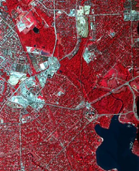 For decades, arborists and urban planners alike have struggled with how best to evaluate and maintain Dallas’ urban forests. A vital source of greenery, environmental protection and quality of life, these forests were previously cataloged by volunteers on foot with handheld GPS devices. At best, the results were a rough, inaccurate patchwork portrayal of the variety and number of trees in a given area.
A new technique pioneered by Dr. Fang Qiu, associate professor in geospatial information sciences in the School of Economic, Political and Policy Sciences, has produced a comprehensive survey of some of the Dallas forest — and he did it leaf by leaf. The effort marks the first time any metropolitan area has surveyed trees with the Qiu’s novel, two-step approach.
Qiu was commissioned by Steve Houser, who chairs the Dallas Urban Forest Advisory Committee.
UTD Professor Wins NASA Grant to Develop Geospatial Earth Science Database
RICHARDSON, Texas (Jan. 10, 2005) — Dr. Fang Qiu, an assistant professor of geographic information sciences at The University of Texas at Dallas (UTD), has been awarded a $70,000 grant from the National Aeronautics and Space Administration (NASA) to help create a system that will track scientific information about the Earth for use in higher education.The grant was funded under NASA’s Earth Observing System (EOS) Higher Education Alliance, and Qiu will serve as co-investigator of the initiative, alongside researchers from George Mason University in Fairfax, Va., the City University of New York and Northern Illinois University.