Ph.D. - Geosciences
University of Arizona - 1976
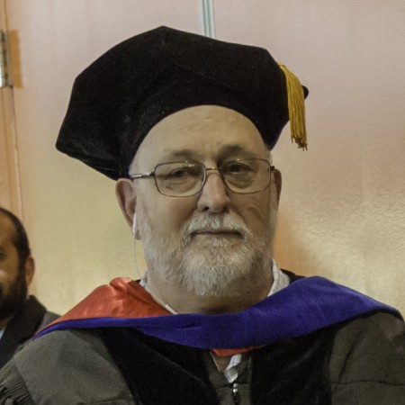
In Memory of
Carlos Aiken
Former Professor Emeritus - Geosciences
Professional Preparation
M.S. - Geological Sciences
University of Washington - 1970
University of Washington - 1970
B.S. - Geology
University of Washington - 1965
University of Washington - 1965
Research Areas
Research Interests
Potential fields applied to tectonics, resources (hydrocarbons, minerals, geothermal), and geotechnical and environmental problems. Emphasis on gravity including developing new digital gravity data acquisition methodology for higher accuracy and resolution applications (including developing terrain mapping techniques with reflectorless laser rangefinders for inner zone terrain corrections); hydrocarbon reservoir management by gravity in a test on the North Slope of Alaska. Development of gravity and magnetic data bases of Mexico and Ecuador.
Global Positioning System (GPS) applications to geophysics and geology. Emphasis on rapid survey techniques and special attention to the problem of using GPS ellipsoid heights for land surveys. Applied in-house geoid modeling to corrections to heights in geosciences applications. Building a centimeter accuracy geoid model for the Texas Gulf Coast with UT-Austin and Texas A&M tied to tidal gauges for coastal hazard studies and mapping of sea level.
Geographic Information Systems (GIS) applied to geology and geophysics. Built GIS geologic databases of Venezuela, China, and Ecuador and multi-layer GIS databases of Mexico
Developing new digital data acquisition (mapping) techniques using field computers, GPS, GIS and reflectorless laser rangefinders in which both high resolution terrain and specific geologic feature (bedding, faults, etc.) mapping is carried out. Development of real time geological analysis (such as stratigraphic thicknesses, strikes and dips) in the field.
Publications
The 4D microgravity method for waterflood surveillance: Part II-Gravity measurements for the Prudhoe Bay reservoir, Alaska. JF Ferguson, T Chen, J Brady, CL Aiken, J Seibert. Geophysics 72 (2), I33-I43. 2007 - Publication
The digital classroom of tomorrow: Incorporating digital geology and Cybermapping into the undergraduate geosciences curriculum.
D Tuck, C Aiken, X Xu.
2006 Philadelphia Annual Meeting. 2006 - Publication
Digital acquisition, analysis, and visualization in the earth sciences.
JS Oldow, JD Walker, CLV Aiken, X Xu.
Eos, Transactions American Geophysical Union 87 (35), 351-351. 2006 - Publication
Geoid estimation in a coastal region: Corpus Christi, Texas, USA Tianyou Chen, Carlos L.V. Aiken, John Ferguson, Roberto G. Gutierrez, and Gary A. Jeffress Proceedings: Dynamic Planet 2005 Monitoring and Understanding a Dynamic Planet with Geodetic and Oceanographic Tools. Cairns, Australia , August 22-26, 2005 Joint Assembly of International Associations: IAG, IAPSO and IABO 2005 - Publication
Xu, X., Aiken, C.L.V., Corbeanu, R.M., Zeng, X., McMechan, G.A., and Bhattacharya, J.P., submitted to Geophysics, High accuracy 3-D digital integration, visualization and analysis of geologic data: Reservoir characterization of the Ferron Sandstone, Utah. 2005 - Publication
Zeng, X., McMechan, G.A., Bhattacharya, J.P., Aiken, C.L.V., Xu, X., Hammon III, W.S., and Corbeanu, R.M., submitted to Geophysical Prospecting,. 3-D imaging of a reservoir analog in point bar deposits in the Ferron sandstone, Utah using ground-penetrating radar.. 2005 - Publication
Integrated study of ancient delta front deposits, using outcrop, ground penetrating radar and three dimension photorealistic data: Cretaceous Panther Tongue sandstone, Utah C. Olariu, J., Bhattacharya,, X., Xu, C, Aiken, X. Zeng, and G. McMechan, River Deltas: Concepts, Models and Examples J.P.Bhattacharya and L. Giosan (eds.). Tulsa, SEPM Special Publication 83. (2005) 2005 - Publication
Olariu, C., Bhattacharya, J. P., Xu, X., Aiken, C.L.V., Zeng, X., and McMechan, G. A., 2005, Integrated study of ancient delta front deposits, using outcrop, ground penetrating radar and three dimension photorealistic data: Cretaceous Panther Tongue sandstone, Utah. in: J.P.Bhattacharya and L. Giosan (eds.) River Deltas: Concepts, Models and Examples. SEPM Special Publication 83. 2005 - Publication
Appointments
Instructor
Texas Society of Professional Surveyors [2004–2004]
Texas Society of Professional Surveyors [2004–2004]
Instructor
2004 AAPG Convention, Richardson, TX [2004–2004]
2004 AAPG Convention, Richardson, TX [2004–2004]
Instructor
Univ. of Idaho, Moscow, Idaho [2003–2003]
Univ. of Idaho, Moscow, Idaho [2003–2003]
Instructor
Seminar (1 day) ExxonMobil Upstream Research Co. [2003–2003]
Seminar (1 day) ExxonMobil Upstream Research Co. [2003–2003]
Registered Professional Geophysicist
State of Texas [2003–Present]
State of Texas [2003–Present]
Instructor
San Diego State University, Mesa, California [2003–2003]
San Diego State University, Mesa, California [2003–2003]
Instructor
Norsk Hydro ASA, Bergen, Norway [2000–2000]
Norsk Hydro ASA, Bergen, Norway [2000–2000]
Instructor
Seminar (1 day) ExxonMobil Upstream Research Co. [2000–2000]
Seminar (1 day) ExxonMobil Upstream Research Co. [2000–2000]
Instructor
Geological Society of America Short Course, Reno, NV [2000–2000]
Geological Society of America Short Course, Reno, NV [2000–2000]
Co-instructor
Geological Society of America Short Course, Denver, CO [1999–1999]
Geological Society of America Short Course, Denver, CO [1999–1999]
Additional Information
Professional Societies
- Society of Exploration Geophysicists
- American Geophysical Union
- Institute of Navigation
- Dallas Geophysical Society
- American Association of Petroleum Geologists
Awards
- Frank Kottlowski Memorial Award (best paper), 2002, American Association of Petroleum Geologists Annual meeting-- Janok P. Bhattacharya Carlos V. Aiken, Rucsandra M. Corbeanu, George A. McMechan. Xueming Xu and Xiaoxian Zeng, all with the University of Texas at Dallas; and Christopher D. White, with Louisiana State University, Baton Rouge, La., for "3-D Outcrop Reservoir Characterization )
- Best Presentation Award: 2003: THE USE OF GROUND-BASED LASER SCANNERS, GPS AND DIGITAL CAMERAS TO RAPIDLY CREATE 3D VIRTUAL MODELS, September, Institute of Navigation-Global Positioning System
University Activities
- Member Search Committee, Green Geophysics Professorship, 1984-1988
- Member Search Committee, Carbonate Professor, 1984
- Chairman, Geophysics Exhibit Committee, 1987;1989
- Chairman, Curriculum Committee, Geosciences Program, UTD, 1983
- Undergraduate Advisor, Programs in Geosciences, University of Texas at Dallas, 1982-1985
- Chairman, Library Committee, University of Texas at Dallas, 1981-1988
- Several Graduate Advisory Committees, Southern Methodist University
- Ad hoc committee Chairman, three committees; ad hoc member, one committee.
- Admissions Committee, Geosciences, 1988-
- Remote Sensing Study Committee, Chairman, 1988
- Geosciences Management Committee, 1994
- Geosciences Curriculum Committee, 1994-2000
- Geosciences Graduate Advisor, 1997-2000
- Geographic Information Sciences MS Committee, 1997-
- Parking and Safety Committee, 1997-2000
- Search Committee, Seismology position, 1998-1999
- Vice-Chairman, G.I.S. Coordinating Committee 1998-
- Member, GIS Position Search Committee, Social Sciences, 1999
- University Scholarship Committee, 2000-2003
- Dept. Seminar chairman 2003-2004
News Articles
Geoscientist Joins Team Studying Massive Sinkhole
 A UT Dallas researcher is working with geological scientists from two other universities to study a gargantuan sinkhole that has swallowed a huge chunk of the East Texas town of Daisetta. Professor Carlos Aiken of the School of Natural Sciences and Mathematics was to arrive Monday at the sinkhole site to conduct detailed measurements with the aim of assessing whether the sinkhole is growing. Dr. Aiken is working with researchers from Louisiana State University and the University of Idaho. The team will work with a terrestrial laser scanner combined with Global Positioning System (GPS) and high-resolution photography to image the surface expression of the sinkhole to accuracies of a few millimeters.