PhD - Geography
Syracuse University - 2013
Professional Preparation
MPhil - Geographic Information Systems and Remote Sensing
University of Cambridge - 2003
University of Cambridge - 2003
MSc - Natural Resource Management
University of the West Indies - 2002
University of the West Indies - 2002
BSc - Agriculture
University of Guyana - 1999
University of Guyana - 1999
Research Areas
Remote sensing, sustainability, natural resource management, land-use planning, spatial analysis, society and environment, biodiversity conservationNews Articles
Descendants of the Old Forest
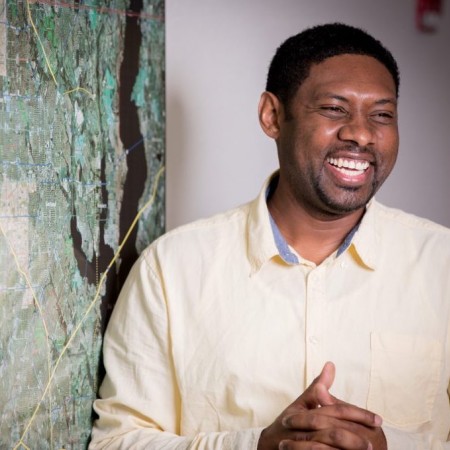
 The son of peanut farmers, Dr. Anthony Cummings, assistant professor in the geospatial information sciences program at UT Dallas, walked the forests of Guyana, South America as a boy. In the tropics of the Caribbean, he learned to use a bow and arrow, and entertained the dream of becoming a professional cricketer. While he pursued his education, he grew curious about the differences between his family’s farming practices and others. A need for fertilizer and constant maintenance to their land brought Dr. Cummings to the understanding that economics plays a key role in farming efforts, but there was something more interesting happening on indigenous lands.
Professor Uses Drones To Track Human Impact on Rainforest
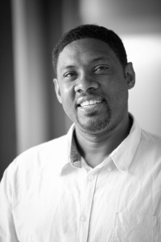
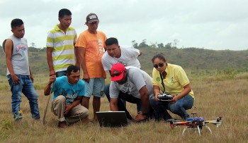
 Dr. Anthony Cummings sat down with leaders of an indigenous community in Guyana last summer to share an unconventional idea to help them conserve the land their people have lived on for thousands of years.
The assistant professor of geospatial information sciences in UT Dallas' School of Economic, Political and Policy Sciences wanted to use drones to capture images of the Makushi people’s Amazon rainforest farmland. The goal was to track and study how changes on their farming plots affect the ecosystem and wildlife over time.
Professor Uses Drones To Track Human Impact on Rainforest
 Dr. Anthony Cummings sat down with leaders of an indigenous community in Guyana last summer to share an unconventional idea to help them conserve the land their people have lived on for thousands of years.
The assistant professor of geospatial information sciences in UT Dallas' School of Economic, Political and Policy Sciences wanted to use drones to capture images of the Makushi people’s Amazon rainforest farmland. The goal was to track and study how changes on their farming plots affect the ecosystem and wildlife over time.